
How we helped insurance company to determine scale of damaged area according to the wheat lodging degree?
Using the patented method of calculation of crop damage area according to the plant lodging degree.
GENERALI Insurance Company is one of the first three strongest insurance companies on the slovak market and one of the TOP 10 in the world. It is a universal insurer of life and non-life insurance.
As part of agricultural insurance, it insures crops against risks such as hail, storms, floods and other risks.
| CLIENT | GENERALI Poisťovňa, a.s. |
| PLACE | Neded village, ŠAĽA district, SLOVAKIA |
| PLOTS | 3 agricultural fields |
| AREA COVERED | 299 ha |
| INSURED CEREALS | common wheat |
| DATE OF MEASUREMENT | 28th of June 2018 |
CLIENT REQUEST

The client´s request within the insurance event monitoring was to define the total damaged area and to define the damaged area according to the pre-selected degrees of ear position.
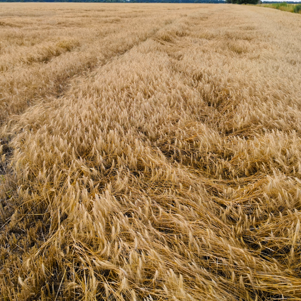
In three fields with sown wheat, in the village NEDED, district ŠAĽA, in Slovakia, with a total area of 299 hectares, there was an insured event due to unfavorable weather conditions – the lying of wheat ears.
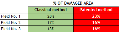
CLASSIC MONITORING METHOD
At the present, the manual methods for the damage evaluation in the field are used. Usually, sample counts of local areas are conducted, which are then statistically implemented as a whole. These methods are very laborious and time consuming. They are very often also higly inaccurate, leading to an incorrect estimate of the extent of field damage.
NEW PATENTED MONITORING METHOD
We used the innovative method for precise identification and interpretation areas of lodged crops field. We carried out the following activities:
Data capturing in the affected field
Mapping of damaged vegetation by aerial photogrammetry methods using UAV (drones), in the local coordinate system with 2nd class of geodetic accuracy.
Processing of captured data
- Creating a digital terrain model
- Creating a digital surface model of lying ears
- Creating a digital vector maps
- Calculation of the degree of ear position according to the patented procedure
- Classification of ears into classes depending on the angle
- Calculation of the extent of damaged areas according to individual classes (position angles), according to the patented procedure
OUTPUTS DELIVERED TO THE CLIENT
Maps of wheat lodging according to the lodging degree

Level of lodging: The ground
Area: 40 902 m²

Level of lodging: 76-85°
Area: 16 018 m²

Level of lodging: 66-75°
Area: 18 215 m²

Level of lodging: 56-65°
Area: 295 735 m²

Level of lodging: 46-55°
Area: 372 363 m²

Level of lodging: 36-45°
Area: 322 125 m²

Level of lodging: 26-35°
Area: 175 243 m²

Level of lodging: 16-25°
Area: 77 718 m²

Level of lodging: 6-15°
Area: 22 874 m²

Level of lodging: 0-5°
Area: 14 887 m²
Defination of damaged area according to the wheat lodging degree
RESULTS
Based on the delivered data, verified also by an authorized surveyor, the insurance company determined the average degree of wheat lodging and the extent of field damage as follows:

Precise calculation of crop damage area according to the plant lodging degree is protected by Utility model named „Method of identifying and displaying areas of lodged crops field“.